Mississippi River Flooding
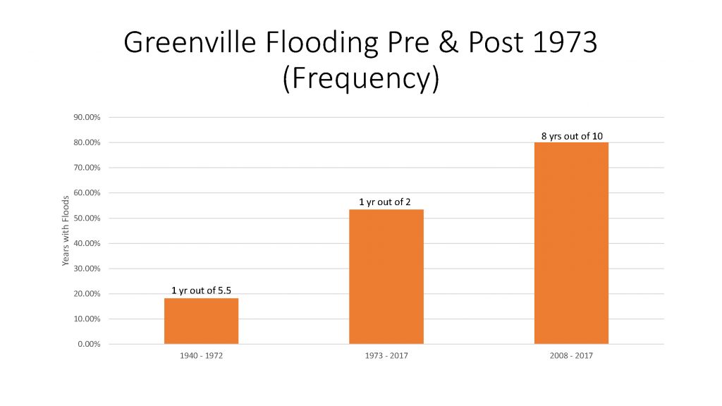
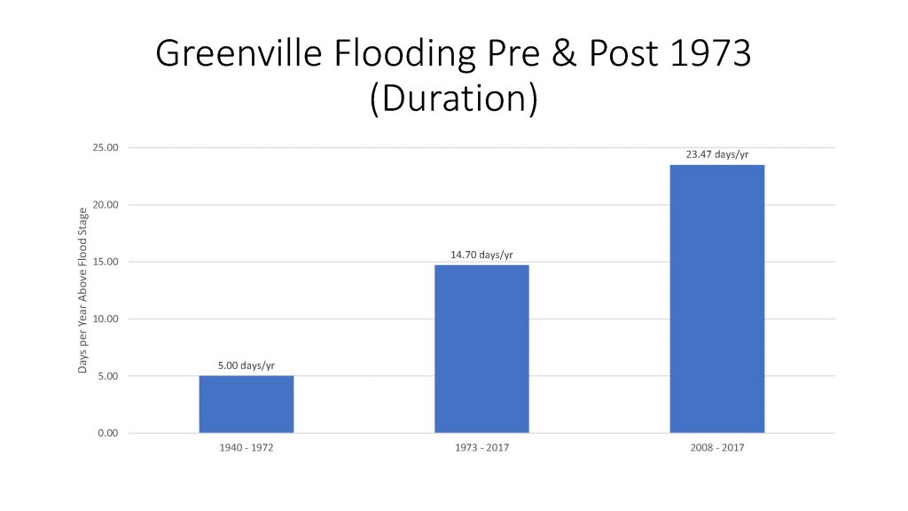
Beginning in 1973, the Mississippi River started to rise and to flood more from Greenville to Baton Rouge. The floods are more frequent, longer and higher. Why? It isn’t more rain. Average rainfall has increased very little since 1940. What’s causing it? And what can be done about it?
We think work by the US Army Corps of Engineers on the river and urban development upriver are the primary causes. The Corps has shortened, straightened, and channelized the river. This has increased the flow to the lower river. Faster runoff from development upriver has also increased the flow. But the Corps has not increased the discharge to the Gulf to handle the greater flow. So the river rises, backs up, and floods more.
In fact, the discharge to the Gulf has actually decreased. This was confirmed recently by Dr. Hi-Jun Xu, hydrologist at LSU. He said a section of the river bed just below the Old River Control Complex has risen more than 30 feet in the last 20 years. He said it acts like a “stopper” causing the water to back up and rise
Recent Charts
Greenville Flooding Pre and Post 1973 Frequency
Greenville Flooding Pre and Post 1973 Frequency
Greenville Flooding Pre and Post 1973 Duration: Annual Days above Flood Stage all years
Greenville Flooding Pre and Post 1973 Duration: Annual Days above Flood Stage all years
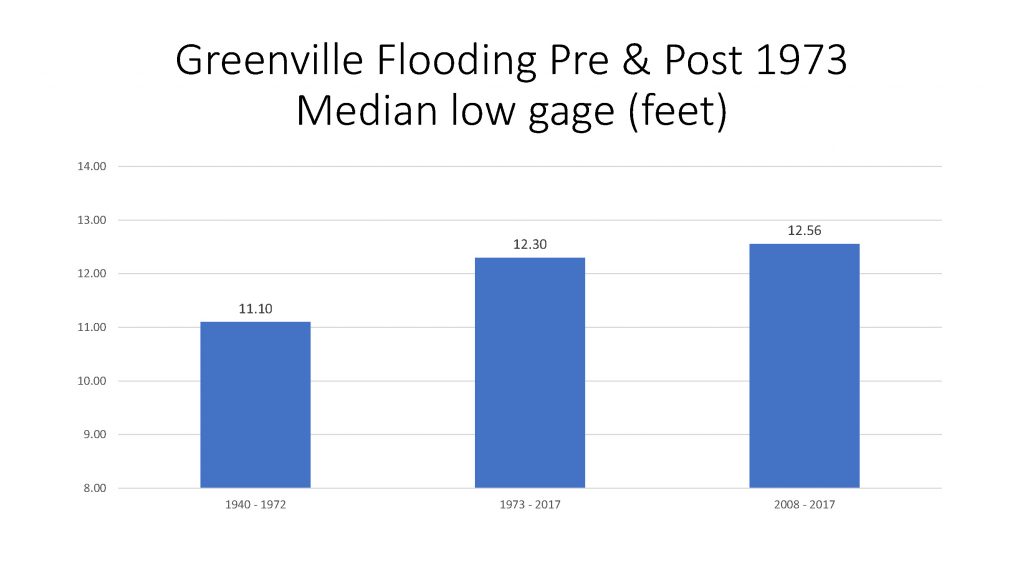
Greenville Flooding Pre and Post 1973 Median low gage
Greenville Flooding Pre and Post 1973 Median low gage
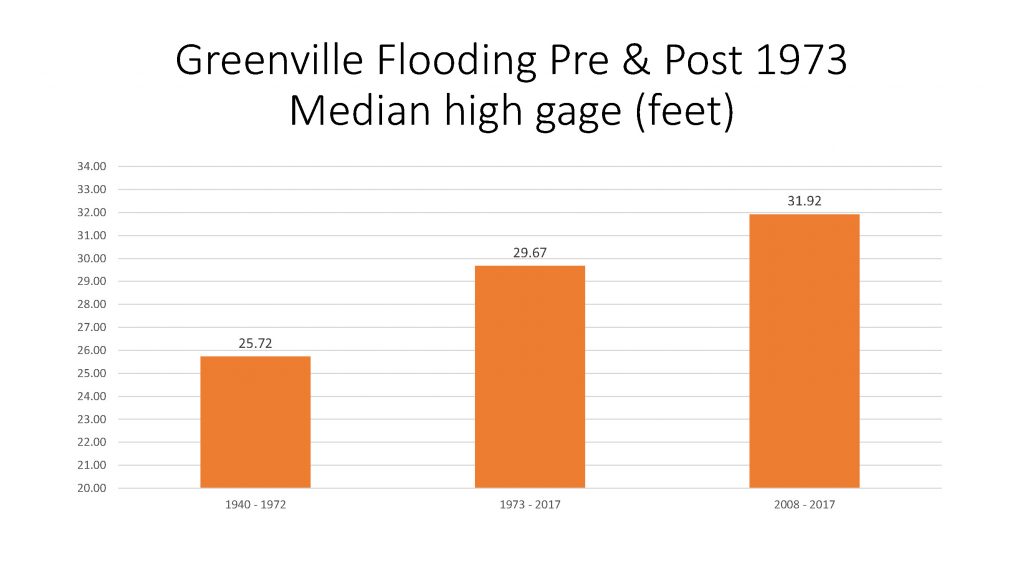
Greenville Flooding Pre and Post 1973 Median high gage
Greenville Flooding Pre and Post 1973 Median high gage
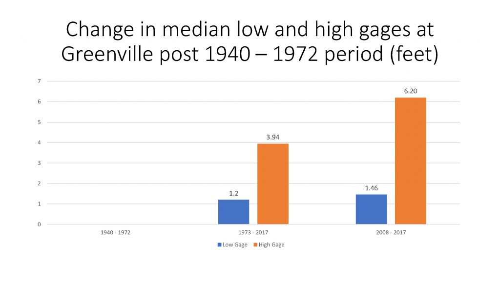
Change in median low and high gages at Greenville post 1940 – 1972 period
Change in median low and high gages at Greenville post 1940 – 1972 period

